Table of Contents
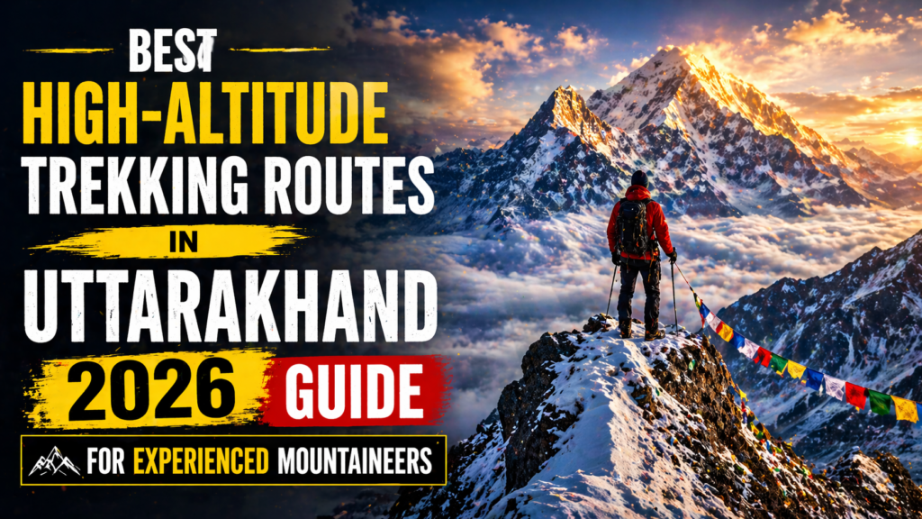
Best High-Altitude Trekking Routes in Uttarakhand for Experienced Mountaineers (2026 Guide)
There’s a specific kind of silence you encounter above 4,500 metres in Uttarakhand — no birds, no wind, just the crunch of crampons on ice and your own heartbeat. That’s not poetic license. That’s exactly what you’ll experience on this state’s most demanding trails, where the Himalayas stop being a backdrop and start being a full-body confrontation.
If you’ve already done Kedarkantha and Valley of Flowers and you’re quietly thinking “okay, what’s next?” — this guide is written for you. The best High-Altitude Trekking Routes in Uttarakhand for experienced mountaineers aren’t listed in glossy brochures. They require permits, technical gear, proper acclimatisation, and an honest conversation with yourself about fitness. But what they give back? Absolutely nothing compares.
Here’s everything you need to plan your next serious Himalayan objective.
Why Uttarakhand Is India’s Ultimate Mountaineering Playground
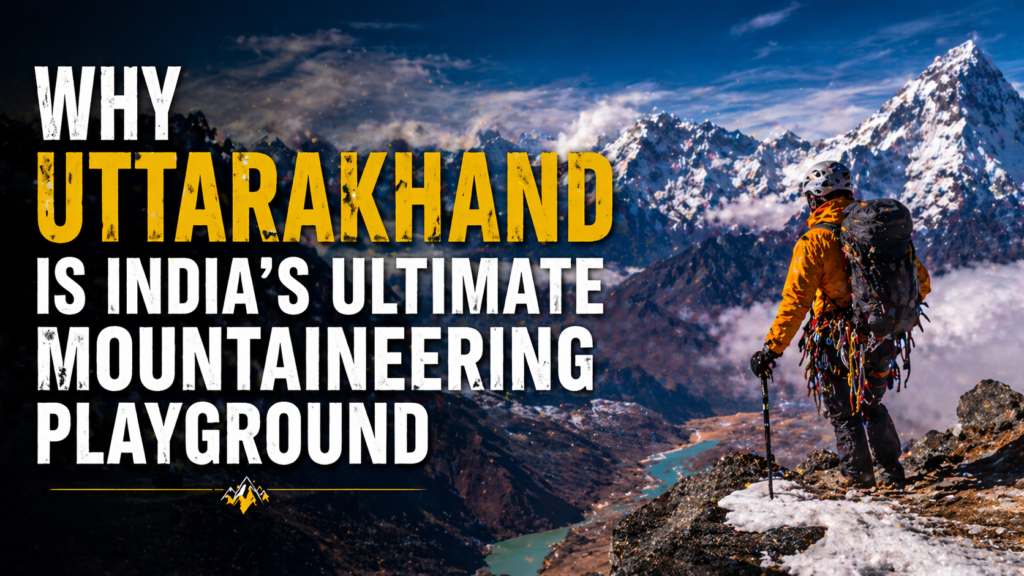
Uttarakhand sits at the crossroads of two major Himalayan ranges — the Garhwal Himalayas in the west and the Kumaon Himalayas in the east. The state shares borders with Tibet (China) to the north and Nepal to the northeast, which means the terrain is relentlessly vertical and the weather utterly unforgiving.
The altitude range here is extraordinary. You can start a trek at 1,800 metres in Gangotri town and push to a 5,947-metre pass within five days. The state contains 30+ peaks above 6,000 metres, including Nanda Devi (7,816m) — India’s second-highest mountain and the centrepiece of the Nanda Devi Biosphere Reserve, a UNESCO World Heritage Site with some of the strictest trekking regulations in the country.
Here’s something most people don’t realise: Uttarakhand has more glaciers than any other Indian state — over 900 glaciers covering roughly 3,550 sq km. The Gangotri Glacier alone stretches 30 km and is the primary source of the Bhagirathi River. When you’re crossing a moraine field at 5,200 metres and wondering why this feels nothing like a normal trek — that’s why.
The Nehru Institute of Mountaineering (NIM) in Uttarkashi and the Indian Mountaineering Foundation (IMF) in Delhi regulate most high-altitude expeditions. Permits from these bodies aren’t optional — they’re compulsory for restricted zones and peak climbs.
The High-Altitude Trekking Routes in Uttarakhand — Ranked by What They’ll Take From You
1. Kalindikhal Pass (5,947m) — The Route That Earns Lifetime Bragging Rights
Distance: ~105 km | Duration: 14–16 days | Base: Gangotri (3,048m)

Let’s be honest — Kalindikhal is the reason experienced trekkers keep coming back to Uttarakhand. It’s not just a pass crossing. It’s a full traverse connecting Gangotri in Garhwal to Badrinath, crossing the high-altitude Chaturangi Glacier, negotiating near-vertical ice walls, and navigating moraine fields that feel like the surface of the moon.
The crux section — the final push to the pass at 5,947m — involves 40–50° ice slopes. Fixed ropes are sometimes left by previous teams, but don’t count on them. You need crampons, ice axe self-arrest skills, and ideally some prior experience on alpine terrain above 5,500m.
The views from the pass? The entire Gangotri massif laid out in front of you, with Shivling (6,543m), Thalay Sagar (6,904m), and Bhagirathi peaks cutting the horizon. Actually, wait — “views” doesn’t cover it. It’s more like a full-system reset.
Key details:
- Permit required: Yes — from District Magistrate, Uttarkashi + IMF registration recommended
- Technical gear: Crampons, ice axe, rope, harness, helmet
- Best season: Mid-May to mid-June, mid-September to early October
- Guide essential: Yes — local guides from Gangotri with glacier experience
- Approx cost: ₹45,000–₹75,000 per person (guided, full service)
- Fitness baseline: Must have prior 5,000m+ trekking experience
“Kalindikhal is not a trek. It is an examination.” — Common saying among Uttarkashi guides
2. Auden’s Col (5,490m) — The Forgotten Classic That Geologists Dream About
Distance: ~90 km | Duration: 12–14 days | Base: Gangotri (3,048m)

Named after John Bicknell Auden — a British geologist who crossed it in 1935 — this route connects the Gangotri region to Kedarnath via the Rudugaira and Khatling glaciers. It’s technically demanding, extraordinarily remote, and frankly under-discussed given how spectacular it is.
The approach from Gangotri takes you through Nala camp and Rudugaira base before the actual glacier crossing begins. The col itself involves sustained steep snow — expect 50°+ sections — followed by a long descent to Khatling Glacier on the Kedarnath side.
What makes Auden’s Col unique is the geological drama. You’re literally walking across an ancient glacial divide that separates two river systems (Bhilangana and Bhagirathi). The rock formations here are genuinely unlike anything else in Uttarakhand.
Click for more information about Auden’s col trek.
Key details:
- Permit: Restricted zone — Inner Line Permit from DM Uttarkashi + Forest Department clearance
- Technical gear: Full glacier kit — crampons, axe, rope, crevasse rescue equipment
- Best season: Late May to mid-June only (extremely narrow window)
- Guide essential: Absolutely — route finding is near-impossible without experience
- Approx cost: ₹40,000–₹65,000 per person
- Fitness baseline: 5,000m+ experience + basic crevasse rescue training
3. Milam Glacier Trek (3,870m to 4,500m+) — Kumaon’s Grandest Glacier Walk
Distance: ~56 km one way | Duration: 10–12 days | Base: Munsiyari (2,200m)
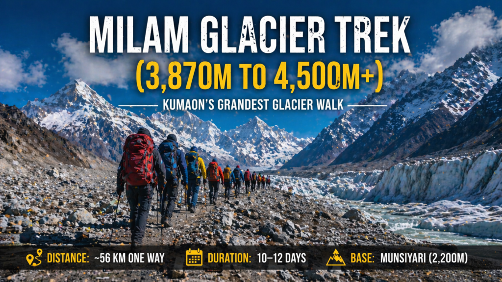
Milam Glacier — roughly 16 km long — sits in Pithoragarh district and feeds the Gori Ganga River. Until the 1962 Sino-Indian War, the Milam valley was a thriving trade route between Kumaon and Tibet. The villages en route — Lilam, Bogudiyar, Rilkot, Burphu — still carry traces of that ancient trans-Himalayan commerce.
The trek to the snout of the glacier isn’t technically demanding by itself. But experienced mountaineers use Milam as a base for further objectives: Nanda Devi East Base Camp approach, Milam Glacier crossing to Ralam, or the assault on surrounding 5,500–6,000m peaks like Hardeol (7,151m) and Tirsuli (7,074m).
Permits here are stricter than most realise. The area falls under the Inner Line Permit zone — you’ll need clearance from the District Magistrate of Pithoragarh at least 15 days in advance.
The smell of the Munsiyari pines as you climb above 2,500m, the cold Gori Ganga mist on your face at dawn, and the sheer scale of the terminal moraine — this one gets under your skin in a way that’s hard to explain.
Key details:
- Permit: Inner Line Permit — DM Pithoragarh (₹200–₹600 per person)
- Technical gear: Trekking poles mandatory; crampons if venturing onto glacier
- Best season: May–June, September–October
- Guide: Recommended — available in Munsiyari (₹800–₹1,200/day)
- Approx cost: ₹18,000–₹35,000 per person
- GMVN guesthouses available at Munsiyari and Milam village
4. Lamkhaga Pass (5,282m) — The Kinnaur–Garhwal Border Burner
Distance: ~75 km | Duration: 11–13 days | Base: Harsil (2,620m)
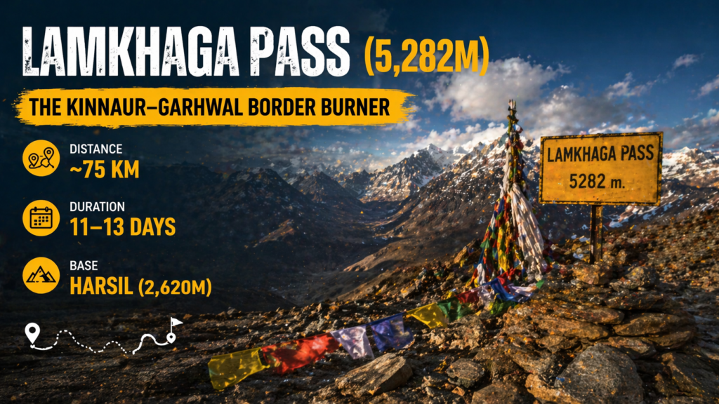
This is one of those routes where even the approach is brutal. Lamkhaga connects Chitkul in Himachal Pradesh’s Kinnaur district to Harsil in Uttarakhand’s Uttarkashi district. Most trekkers do it west to east — Chitkul to Harsil — but the Harsil-based approach has its own merits.
The pass crossing involves loose scree, snowfields, and occasional rock scrambles. It’s not a glacier route, but the combination of altitude, remoteness (you’re in a valley with no phone signal for 5+ days), and weather unpredictability makes it a serious undertaking.
Harsil itself — tucked along the Bhagirathi River at 2,620m — is one of the most beautiful villages in Uttarakhand and worth at least a rest day. The deodar forest above Harsil is stunning in October when the light turns everything amber and gold.
Key details:
- Permit: Required — DM Uttarkashi + Himachal Forest Department
- Technical gear: Trekking poles, microspikes (in season), navigation tools
- Best season: June–July, September
- Approx cost: ₹20,000–₹40,000 per person
- Fitness baseline: 4,500m+ trekking experience, strong cardio fitness
5. Panchachuli Base Camp & Sunderdhungha Valley (3,900m–4,800m)
Distance: ~60 km | Duration: 10–12 days | Base: Munsiyari (2,200m)
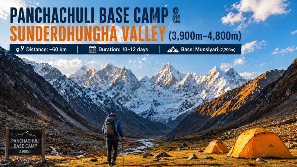
The Panchachuli massif — five peaks ranging from 6,334m to 6,904m — is one of the most visually dramatic mountain groups in India. Local Kumaoni tradition holds that the five peaks represent the five hearths where the Pandavas cooked their last meal before ascending to heaven. Whether or not you buy the mythology, the peaks are genuinely extraordinary.
The Sunderdhungha valley approach involves crossing the Sunderdhungha Glacier and offers views of Maiktoli (6,803m) and Tharkot (6,099m) that most Indian trekkers have never seen. The valley itself — with its braided glacial streams, moraines, and absolute silence above 4,000m — is worth the entire effort.
This is an excellent objective for experienced trekkers who want glacier exposure without full technical climbing commitments.
6. Shivling Base Camp (4,760m) via Tapovan — Short But No Joke
Distance: ~26 km one way | Duration: 6–8 days | Base: Gangotri (3,048m)
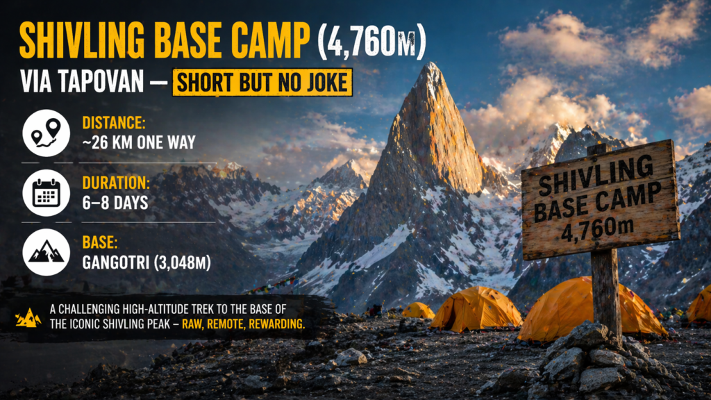
Technically, Tapovan (4,463m) — the meadow directly below Shivling peak — is accessible to fit trekkers without technical gear. But the real draw for experienced mountaineers is the extended approach to Shivling Base Camp proper, traversing sections of the Gangotri Glacier, crossing meltwater streams, and navigating the moraine maze above Nandanvan.
Shivling (6,543m) is considered one of the most aesthetically perfect peaks on Earth. Its granite pyramid shape has drawn alpinists since the first ascent in 1974. If you’re eyeing the peak itself, expect a PD+ to AD-rated route requiring technical ice and rock skills.
For those “just” doing the base camp trek: the Gangotri to Tapovan trail is still a serious undertaking with glacier approach, altitude exposure, and minimal rescue infrastructure.
Key details:
- Peak permit (if climbing): IMF permit — apply minimum 3 months in advance
- Base camp trek: No special permit beyond Gangotri NP entry fee (₹150/day)
- Best season: May–June, September–October
- Approx cost (base camp trek): ₹12,000–₹25,000 per person
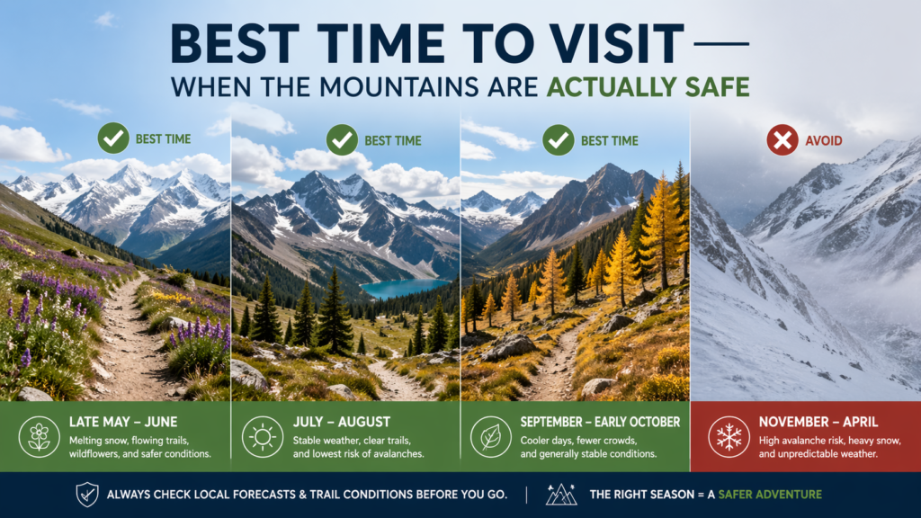
Best Time to Visit — When the Mountains Are Actually Safe
| Season | Months | Temp Range | Crowd Level | Best For |
|---|---|---|---|---|
| Pre-Monsoon | Apr–Jun | -5°C to 15°C | Moderate | Glacier crossings, peak climbs |
| Monsoon | Jul–Aug | 5°C to 18°C | Very Low | Avoid (landslides, unstable ice) |
| Post-Monsoon | Sep–Oct | -8°C to 12°C | Low–Moderate | Trekking, clear skies, stable snow |
| Winter | Nov–Mar | -20°C to 2°C | Extremely Low | Winter mountaineering only |
The sweet spot? Late September to mid-October — post-monsoon clarity, stable snow conditions on passes, and temperatures cold enough to keep the ice firm without being life-threatening. The skies are genuinely that deep Himalayan blue that doesn’t photograph the way it looks in person.
Avoid July–August entirely on technical routes. Glaciers are destabilised by meltwater, river crossings become dangerous, and landslides can cut off approach roads without warning.
How to Reach — Getting to the Mountains Without Losing Your Mind
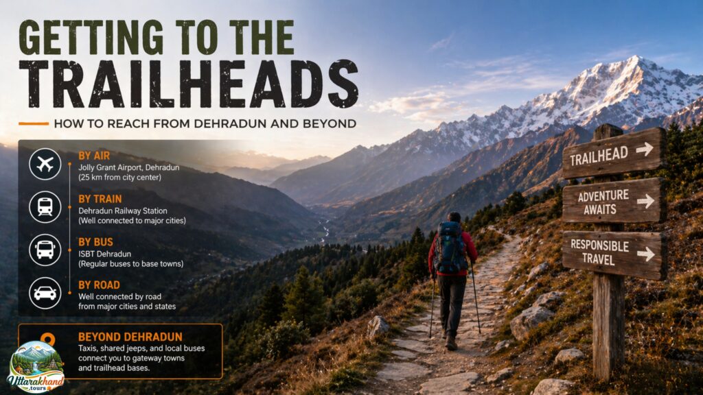
By Air
The nearest functional airport is Jolly Grant Airport, Dehradun (DED) — about 25 km from the city. Flights connect daily from Delhi (45 minutes), Mumbai (2 hours), and Bengaluru. From the airport, pre-paid taxis to Dehradun ISBT cost approximately ₹600–₹800. For Uttarkashi (Garhwal base), expect a ₹3,500–₹5,000 taxi directly from the airport (6–7 hours). For Munsiyari (Kumaon base), the nearest airport is Naini Saini Airport, Pithoragarh — limited connectivity but operational for small aircraft.
By Rail
Haridwar Railway Station and Dehradun Railway Station are your best bets. The Shatabdi Express from Delhi to Haridwar takes roughly 4.5 hours — book on IRCTC well in advance during peak season. From Haridwar, GMVN-operated buses run to Uttarkashi (₹250–₹350, 8–9 hours) and shared taxis to Rishikesh for onward connections.
By Road
From Delhi to Gangotri (base for Kalindikhal, Auden’s Col, Shivling): approximately 490 km, 13–15 hours. The NH-58 via Haridwar–Rishikesh–Devprayag–Uttarkashi is the standard route. Road conditions beyond Uttarkashi can be rough — especially after monsoon. Always check Uttarakhand Tourism’s official site for road closure updates.
For Munsiyari (Milam Glacier base): Delhi to Munsiyari ~590 km, 16–18 hours. The route via Haldwani–Almora–Bageshwar–Thal is better maintained than Maps sometimes suggests — trust the locals on this one.
Where to Stay — From Tent to Teahouse

Budget (Under ₹1,500/night)
GMVN Tourist Rest Houses are scattered across all major trekking base towns — Gangotri (₹600–₹1,200), Uttarkashi (₹800–₹1,400), Munsiyari (₹700–₹1,100). Basic rooms, hot water sometimes, but reliable and bookable via GMVN’s official portal. Uttarkashi also has several dharmshalas near the Vishwanath Temple that charge ₹200–₹400 per person.
Mid-Range (₹1,500–₹4,000)
Hotel Dhanwant in Uttarkashi (₹1,800–₹2,800) is solid — clean rooms, decent food, and the owner has useful local knowledge about current trail conditions. In Munsiyari, Himalayan Abode (₹2,000–₹3,200) offers good mountain views and reliable hot water — essential after a long trekking day.
Premium (₹4,000+)
Snow View Retreat, Munsiyari (₹4,500–₹7,000) offers the best Panchachuli views of any property in the region. Worth the splurge for at least one night.
Homestays
The Uttarakhand government’s uttarastays.com portal lists verified homestays across trekking base towns. Personally, I’d always pick a homestay over a hotel in these areas — the food is better, the information is fresher, and the conversations are worth more than any guidebook.
Where I’d stay: A homestay in Bagori village near Harsil — roughly 8 km before Gangotri, surrounded by deodar forest, and run by a family who’s been feeding trekkers for 20 years. Ask around in Harsil — you’ll find it.
Food on the Trail — Fuel, Not Gourmet

Don’t expect elaborate menus above the treeline. But what you will find in base towns and dhaba stops is some of the most satisfying food you’ve ever eaten — because your body is running on empty and everything tastes better at altitude.
Uttarkashi dhabas serve excellent rajma chawal (₹80–₹120) and thick, slightly smoky dal that clings to the back of your throat in a way that feels medicinal after a long day. The chai here — made with local jaggery and ginger — is not “nice.” It’s necessary.
On the trail, most guided expeditions carry a cook. Expect: poha and boiled eggs for breakfast, dal-roti at lunch camps, and khichdi or pasta in the evenings. Carry your own high-calorie snacks — dry fruits, Snickers bars, roasted chana, and electrolyte sachets — from Delhi. You won’t find them after Uttarkashi.
In Munsiyari, the Kafal Café near the main market makes decent momos and thukpa (₹100–₹160). The flavours aren’t subtle — garlic-heavy, ginger-forward, exactly what you need before a cold night.
Suggested Itinerary — Kalindikhal Pass (14-Day Route)
| Day | Morning | Afternoon | Evening | Stay |
|---|---|---|---|---|
| Day 1 | Delhi → Haridwar (train) | Haridwar → Uttarkashi (taxi/bus) | Settle in, gear check | Uttarkashi (GMVN/Homestay) |
| Day 2 | Rest + acclimatisation walk | Gear rental/permit collection | Local market | Uttarkashi |
| Day 3 | Drive to Gangotri (3,048m) | Temple visit, register at forest post | Rest | Gangotri (GMVN/camp) |
| Day 4 | Trek Gangotri → Chirbasa (3,600m) | 9 km, 4–5 hrs, forest trail | Camp setup | Chirbasa camp |
| Day 5 | Chirbasa → Bhojbasa (3,792m) | 5 km, treeline ends | Evening tea at Lal Baba Ashram | Bhojbasa camp |
| Day 6 | Bhojbasa → Nandanvan (4,338m) | Glacier crossing begins | Rest, altitude check | Nandanvan camp |
| Day 7 | Acclimatisation day | Short walk to Vasuki Tal | Evening briefing | Nandanvan |
| Day 8 | Nandanvan → Chaturangi Glacier camp (4,900m) | Steep moraine approach | Rest | High camp |
| Day 9 | Summit push prep | Rest + rope team brief | Gear check | High camp |
| Day 10 | Kalindikhal Pass crossing (5,947m) | Descend to Satopath (4,370m) | Relief dinner | Satopath camp |
| Day 11 | Satopath → Chakratirtha (3,624m) | Valley trail | Rest | Chakratirtha camp |
| Day 12 | Trek to Badrinath (3,133m) | Arrive by afternoon | Temple visit | Badrinath (hotel) |
| Day 13 | Rest/explore Badrinath | Visit Mana village (last Indian village) | Celebration dinner | Badrinath |
| Day 14 | Badrinath → Rishikesh/Haridwar (bus/taxi) | Onwards to Delhi | — | — |
Pro Upgrade: Add 2 days at Nandanvan to attempt Vasuki Tal (4,135m) — a glacial lake with Shivling reflections that will absolutely break your camera’s histogram.
Estimated Cost Breakdown (Per Person, 14-Day Kalindikhal Trek)
| Expense Category | Budget (₹) | Mid-Range (₹) | Premium (₹) |
|---|---|---|---|
| Transport (Delhi return) | 4,500 | 7,500 | 14,000 |
| Accommodation (base towns) | 3,500 | 6,000 | 12,000 |
| Guided trek package (full service) | 28,000 | 45,000 | 70,000 |
| Permits & entry fees | 1,500 | 1,500 | 1,500 |
| Gear rental (if needed) | 3,500 | 0 (own gear) | 0 |
| Food & snacks (extra) | 2,000 | 3,500 | 5,000 |
| Miscellaneous/emergency buffer | 2,000 | 3,000 | 5,000 |
| TOTAL (approx.) | ₹45,000 | ₹66,500 | ₹1,07,500 |
Prices may vary in 2026 please ask with your travel agency. Group size affects per-person guide costs significantly — teams of 4–6 bring costs down by 20–30%.
Travel Tips — The Kind You Won’t Find on a Poster

- BSNL/MTNL is the only reliable network above 3,500m in most Garhwal valleys. Jio and Airtel drop out past Gangotri town entirely. Buy a BSNL SIM in Dehradun.
- Carry ₹15,000–₹20,000 in cash before leaving Uttarkashi. There are no ATMs past this point on Garhwal routes. Munsiyari has one SBI ATM — it’s frequently out of cash during peak season.
- Altitude sickness (AMS) kills plans and people. Never ascend more than 500m per day above 3,500m. Carry Diamox (acetazolamide — 125mg twice daily from 3,000m) but consult a doctor beforehand.
- Clothing layering system: Merino wool base layer + fleece mid-layer + Gore-Tex windproof outer shell. Add an 800-fill down jacket for above 4,500m. “Bring warm clothes” is useless advice at -15°C.
- Permits take time. Inner Line Permits from DM offices can take 5–7 working days. Apply at least 3 weeks before your trek start date — online where possible, in person in Uttarkashi or Pithoragarh.
- IMF peak permits (for climbing objectives) must be applied for through the official IMF portal at least 90 days prior. Fees range from ₹2,000 to ₹15,000 depending on peak height and group size.
- Don’t trust static trail reports. WhatsApp groups like “Uttarkashi Trekkers Network” have real-time conditions from local guides — join before you go.
- Photography in restricted zones near the Tibet border requires special permission — don’t risk it. Stick to the designated corridors.
- Emergency: Uttarkashi District Hospital — 01374-222030. SDRF (State Disaster Response Force) rescue helpline: 1070. Download the NDRF App before you leave.
- Honestly — hire a NIM-trained local guide. Not just for safety. For the stories, the shortcuts, and the extra roti at camp that somehow always appears when you’re about to give up.
FAQs About High-Altitude Trekking Routes in Uttarakhand— The Questions Everyone Actually Asks
Q1. Which is the toughest trek in Uttarakhand for experienced mountaineers?
Kalindikhal Pass (5,947m) is widely considered the most technically demanding trek-style route in Uttarakhand, involving glacier crossings, steep ice slopes, and navigation through the Chaturangi Glacier system. For pure mountaineering, Shivling (6,543m) and Chaukhamba I (7,138m) are in a different category altogether.
Q2. Do I need permits for high-altitude treks in Uttarakhand?
Yes — most routes above 4,500m and all routes near the Tibet/Nepal border require Inner Line Permits from the District Magistrate’s office. Peak climbing requires separate IMF permits. Apply well in advance — walk-in approvals are unreliable in 2026 due to increased regulation.
Q3. Is Auden’s Col safe for solo trekkers?
No. Auden’s Col involves serious crevasse risk on the Rudugaira and Khatling glaciers. Solo travel here is not just inadvisable — it’s illegal in the restricted zone. You must be accompanied by a registered guide and trek in a minimum group of two.
Q4. What experience level do I need for the Milam Glacier trek?
Milam Glacier Base Camp is achievable for fit trekkers with 3,500m+ experience. But if you’re venturing onto the glacier itself or approaching Nanda Devi East, you need prior glacier travel experience, self-arrest skills, and crevasse rescue training.
Q5. How much does a guided trek on Kalindikhal Pass cost in 2026?
A fully guided, fully serviced 14-day Kalindikhal trek costs approximately ₹45,000–₹75,000 per person depending on group size and agency. This includes permits, guide, cook, porters, camping equipment, and meals on trail. Budget an additional ₹8,000–₹12,000 for transport from Delhi.
Q6. Is Kalindikhal better than Auden’s Col?
Different objectives, honestly. Kalindikhal is higher (5,947m vs 5,490m), more technically demanding, and offers better mountain panoramas. Auden’s Col is more remote, has richer geological interest, and connects two completely different cultural zones. If you can only do one in a lifetime — Kalindikhal. If you want the one fewer people have done — Auden’s Col.
Q7. When is the best month for glacier treks in Uttarakhand in 2026?
Late September to early October 2026 is the optimal window — post-monsoon stability, firm snow on passes, and exceptional visibility. The pre-monsoon window (mid-May to mid-June) is second-best but carries higher avalanche risk on north-facing slopes.
Q8. Is the Panchachuli Base Camp trek suitable for beginners?
No. The Sunderdhungha approach to Panchachuli Base Camp involves glacier travel, river crossings, and sustained effort at altitude. You need prior experience at 4,000m+ minimum. Experienced trekkers will find it manageable — but don’t underestimate Kumaon’s terrain.
The Mountains Are Calling — Here’s Your Move
There’s a reason mountaineers keep returning to Uttarakhand year after year. It’s not just the altitude or the technical challenge — it’s the feeling of operating at the absolute edge of human geography, in a landscape that has been sacred for thousands of years and remains genuinely wild. These aren’t managed adventure parks. They’re real Himalayas.
With better permit systems, improved GMVN infrastructure, and growing networks of NIM-certified local guides, 2026 is genuinely one of the best years to attempt these routes — especially the post-monsoon window, which is shaping up to be exceptionally clear based on long-range forecasts.
Start planning now. Check permit requirements on the official Uttarakhand Tourism portal, book your NIM-trained guide at least 2 months ahead.
Share this guide with your trekking crew. And when you’re standing on Kalindikhal Pass with nothing but ice and sky around you — you’ll know the planning was worth every hour.
The mountains have been waiting. Now so should you.