Table of Contents
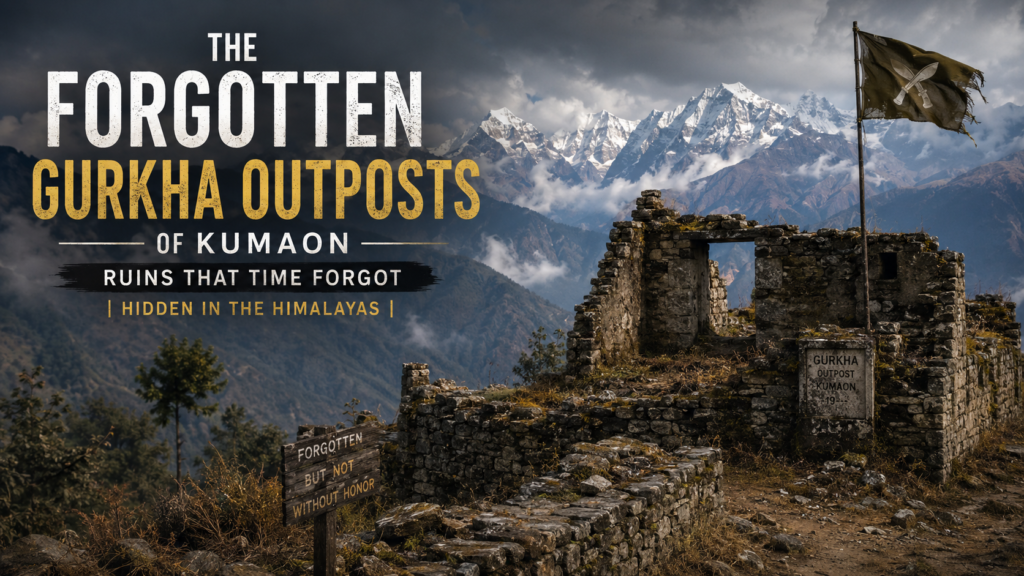
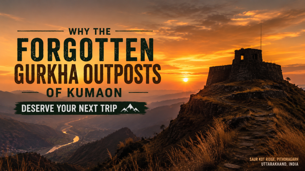
The Forgotten Gurkha Outposts of Kumaon: Ruins That Time Forgot
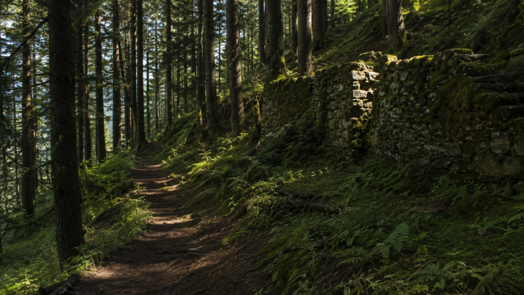
The first time I stood on a crumbling ridge above the Kosi River, the morning mist peeled back just enough to reveal a broken stone parapet swallowed by rhododendron roots. I didn’t need a guidebook. The wind carried the weight of it. The Forgotten Gurkha Outposts of Kumaon don’t announce themselves with ticket counters or polished plaques. They wait. Quiet. Patient. Buried under two centuries of pine needles, monsoon wash, and quiet village life. If you’re chasing the usual temple circuits or crowded viewpoints, you’ll miss them entirely. But walking slowly, reading the land, and listening to the silence reveals a chapter of Himalayan history that textbooks barely touch. Here’s everything needed to plan the perfect trip.
Why These Hills Hold a Secret War
Kumaon doesn’t sit still. It folds into itself, dropping from 2,500-meter ridges down to deep river gorges where the Kosi and Ramganga carve ancient paths. Between 1790 and 1816, this exact terrain became a frontline. Gurkha forces from Nepal swept west, dismantling the Chand dynasty’s control and stringing a chain of garhis (forts) and chowkis (watch posts) across the high ground. These weren’t palaces. They were functional. Built to monitor trade routes, collect taxes, and hold the line against rivals pushing up from the plains.
The Anglo-Nepalese War ended it. The 1816 Treaty of Sugauli handed Kumaon to the British East India Company. The outposts lost their purpose. Nature moved back in.
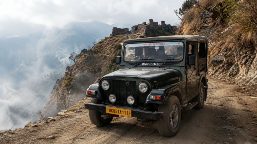
What’s surprising? The Uttarakhand Tourism Department barely lists them on official heritage maps. Yet the stones remain. You’ll find them near old village trails, tucked behind deodar groves, or sitting quietly above modern roads that ignore their existence. The nearest major hub is Kathgodam, roughly 340 km from Delhi via NH9 and NH109. Drive time: 8–9 hours depending on weather. The real journey begins when you leave the highway and take the steep, winding tracks into the hills.
The 25-Year Rule That Changed Everything
Gurkha expansion wasn’t a slow drift. It was a calculated military push. After consolidating power in the Kathmandu Valley, the Gorkha state turned west. Kumaon fell in 1790. The local Chand rulers were pushed aside. In their place came a disciplined administrative system backed by hill forts, signal towers, and armed garrisons.
The outposts served three clear purposes: control, communication, and revenue. A small stone platform on a ridge could spot movement across three valleys. Smoke signals passed messages between posts. Tax collectors moved along secured paths. Life under this rule was strict. Local records mention heavy levies and forced labor for fort maintenance.
Then came the British. The East India Company viewed the Gurkha presence as a direct threat to its northern plains. The 1814–1816 Anglo-Nepalese War broke out. Kumaon’s forts saw skirmishes, supply blockades, and eventual abandonment. The 1816 Treaty of Sugauli drew a hard line. The Kali River became the boundary. Gurkha forces retreated. The British took over.
ASI has documented fragments of this era, but most sites fall outside protected zones. They sit quietly, waiting for walkers who know where to look. The Uttarakhand Tourism Board now acknowledges them in heritage trail proposals, though on-ground signage remains sparse.
Where the Stones Still Speak: Top Outposts to Find
Champawat’s Old Watchtowers
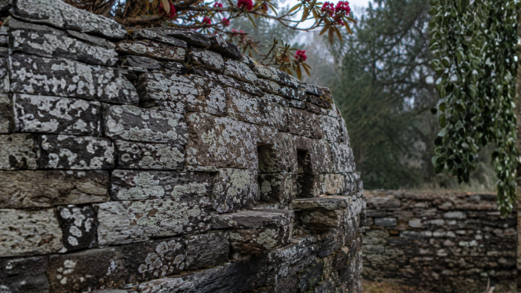
Champawat was never just a town. It was a command node. Gurkha commanders used the high ridges above the Lohaghat valley to monitor movement along the old trade corridor toward Tibet. Today, you’ll find low stone walls, half-collapsed bastions, and narrow loopholes carved into rock faces. The air smells of damp earth and woodsmoke from distant hearths.
Why it matters: It shows how control worked in the hills. Not through massive armies, but through sightlines.
Best time: Late morning, around 9:30 AM. The sun warms the stone, and the mist clears from the valley floor.
Entry & timings: Free. Open year-round. No formal gates.
Insider tip: Park near the old bazaar and walk uphill past the last tea stall. The trail turns into a goat path. Follow it. You’ll hit a terrace with a clear view of the river bend. That’s your spot.
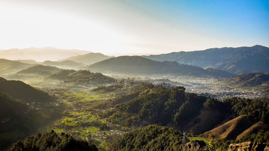
Almora’s Ridge Remnants
Almora’s famous market hides older bones. The Gurkhas reinforced existing Chand-era positions on the Talibagarh and Sherka ridges. What’s left today are fragmented retaining walls, stepped terraces, and water catchments built from local slate. The stone is rough, uneven, and covered in pale green lichen.
Why it matters: It bridges pre-Gurkha and post-Gurkha eras in one location.
Best time: Early evening, 5:00 PM to 6:00 PM. Golden light hits the western ridge. Shadows stretch long.
Entry & timings: Free. Accessible via public paths. Avoid restricted military zones.
Insider tip: Don’t just stick to the main road. Take the footpath behind the district court. It drops into a quiet grove where you’ll find a collapsed guard platform. Locals call it purana kila. They’re right.
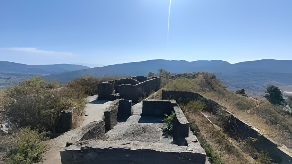
Pithoragarh’s Frontier Bastions
At 1,514 meters, Pithoragarh sits near the eastern edge of Kumaon. The Gurkhas built stronger positions here because it faced direct threats from the plains. You’ll find thicker walls, deeper foundations, and evidence of old armory storage near the old fort complex. The stone is darker here, weathered by harsher winter winds.
Why it matters: It was the eastern anchor of the Gurkha line. Strategic. Tough.
Best time: Mid-morning, 10:00 AM. The valley is bright, and visibility stretches toward the Johar valley.
Entry & timings: Free. Open daily. Some sections near the old cantonment require local permission.
Insider tip: Ask at the KMVN guesthouse for the old chauki trail. It’s unmarked on maps but well-known to shepherds. You’ll find carved stone markers near the tree line.
Askot’s Hidden Ridge Lines
Askot is quieter. Higher. Around 1,800 meters. The Gurkha presence here was lighter but deliberate. Small stone platforms, broken stairways, and drainage channels cut into the hillside remain. The air is sharper. You can hear the Kosi River rushing far below.
Why it matters: It reveals how outposts scaled down as terrain grew harsher.
Best time: Dawn. 5:45 AM. The cold is biting, but the light is crystal clear.
Entry & timings: Free. Open. Forest department patrols occasionally.
Insider tip: Carry a thermos of ginger chai. The wind cuts through fleece. Sit near the old water channel and watch the valley wake up. You’ll feel why they chose this exact spot.
The Overlooked Terrace: Lohaghat’s Upper Ridge
Most blogs skip Lohaghat’s upper ridges. They shouldn’t. A collapsed Gurkha supply post sits behind an old school compound. Stone steps lead nowhere. A broken arch frames a pine canopy. It’s quiet. Untouched.
Why it matters: It shows how quickly function becomes memory.
Best time: Afternoon, 3:00 PM. The light filters through the trees. Perfect for photography.
Entry & timings: Free. Ask at the local panchayat office for trail access.
Insider tip: Go after light rain. The stone darkens. Moss glows. The place feels alive.
More Than Just Walking: What You’ll Actually Do Out There
- Ridge Scanning & Photography
Walk the old sightlines. Capture broken walls against valley drops. 2–3 hours. ₹0. Easy. Pro tip: Use a polarizing filter. It cuts glare off wet stone and brings out lichen textures. - Historical Trail Mapping
Follow old chowki routes using local knowledge. 3 hours. ₹0. Moderate. Pro tip: Carry a printed topo map. Phones fail on steep gradients. - Village Oral History Collection
Sit with elders. Listen. Record stories. 1.5 hours. ₹0. Easy. Pro tip: Bring small notebooks. Offer them as thanks. People remember gestures. - Architectural Detail Study
Focus on masonry, drainage, and defensive angles. 2 hours. ₹0. Easy. Pro tip: Sketch the joint patterns. You’ll see how local stone dictated design. - Sunset Watch from a Bastion
Sit quietly. Watch the light fade over the hills. 1 hour. ₹0. Easy. Pro tip: Arrive 45 minutes early. The temperature drops fast. Layer up. - Guided Heritage Walk
Hire a local historian or ex-forest guard. 3 hours. ₹1,500–₹2,500. Easy. Pro tip: Book through uttarakhand.tours/kumaon-heritage-trail for verified guides. - Night Sky Observation at Ruins
Clear skies. No light pollution. 2 hours. ₹0. Easy. Pro tip: Bring a red-light headlamp. It preserves night vision and doesn’t disturb village dogs.
When the Mountains Breathe: Best Time to Visit

Seasons here don’t just change weather. They change access.
| Season | Months | Temp Range | Crowd Level | Best For |
|---|---|---|---|---|
| Spring | Mar–May | 8–24°C | Moderate | Clear trails, blooming rhododendrons, comfortable hikes |
| Monsoon | Jun–Sep | 15–28°C | Low | Lush greenery, quiet ruins, photography in mist |
| Autumn | Oct–Nov | 5–22°C | Low–Moderate | Crisp air, long sightlines, stable paths |
| Winter | Dec–Feb | 0–15°C | Low–Moderate | Snow-dusted stone, sharp light, fewer visitors |
Spring wakes the hills. Paths dry. Flowers bloom near old walls. Monsoon brings heavy rain. Some trails close. But the ruins look dramatic in the mist. Autumn is my favorite. Skies clear. Temperatures sit right. Roads open fully. Winter is cold but quiet. Frost coats the stone. You’ll have entire ridges to yourself.
The sweet spot? Late October to early November. Here’s why: the monsoon has washed the dust away, the air is sharp, and the winter chill hasn’t set in. Roads stay clear. You’ll get perfect light for photography, and village tea stalls are open. Plus, 2026 road maintenance schedules have improved access to Askot and Lohaghat routes.
Getting There Without the Headache

By Air: Pantnagar Airport is closest to Kumaon. 100 km from Almora. Taxis run daily. Cost: ₹3,500–₹4,500 one-way. Flight time from Delhi: ~1 hour. Book early. Winter fog delays flights. Always carry a backup road plan.
By Rail: Kathgodam Railway Station is the main hub. Direct trains like Ranikhet Express (15014) and Uttarakhand Sampark Kranti run from Delhi. Journey: 6–7 hours. Taxis wait outside. Shared jeeps cost ₹150–₹200 per seat. For detailed schedules, check irctc.co.in..
By Road: Delhi to Kathgodam via NH9. 340 km. 7–8 hours. Road is smooth till Haldwani. After that, it climbs. Buses run from ISBT Kashmere Gate. UKTBC services are reliable. Shared jeeps depart from Haldwani and Kathgodam. Drive time to Champawat: 2 hours. To Pithoragarh: 4.5 hours.
Google Maps tip: Search for “Champawat Heritage Trail Start” instead of just “Champawat.” The route via Gairsain Road avoids the main market bottleneck and drops you closer to old ridge paths. Actually, wait — if you’re carrying heavy camera gear, stick to the main highway until 3 PM. The fog rolls in fast on secondary roads.
Where to Rest Your Bones After Long Walks

Budget (Under ₹1,500/night):
- Pithoragarh KMVN Tourist Rest House — ₹900–₹1,200. Basic rooms. Hot water on request. Close to old fort access.
- Lohaghat Forest Guest House — ₹1,100. Book via Uttarakhand Forest Dept portal. Quiet. No TV. Just trees.
Mid-Range (₹1,500–₹4,000):
- Almora Heritage Inn — ₹2,800. Stone walls. Balcony views. Walking distance to ridge trails.
- Champawat Valley Lodge — ₹3,200. Wooden floors. Local staff. Reliable Wi-Fi for uploading shots.
Premium/Luxury (₹4,000+):
- Askot Mountain Retreat — ₹5,500. Glass windows. Private deck. Naturalist on call.
- Almora Cloud Nine — ₹6,200. Heated floors. Heritage decor. Guided heritage walks included.
Homestays: Check uttarastays.com (Uttarakhand govt portal). ₹1,200–₹2,500. Real Kumaoni kitchens. You’ll get bhatt dal, local honey, and stories that never make it to print.
Camping: Not allowed inside protected heritage zones. Authorized fringe camps near Pithoragarh cost ₹1,800–₹2,500/night. Stick to permitted sites only.
Where I’d stay: A homestay in Champawat. Waking up to woodsmoke, hearing temple bells at dawn, and stepping onto a trail that leads straight to an 18th-century watchtower. That’s the point.
Eat Like You’re Part of the Hills

Food here isn’t just fuel. It’s memory.
- Kafuli (Garhwali/Kumaoni spinach & fenugreek stew): Thick, earthy, slow-cooked. Tastes like damp soil and warmth. Try at Kumaoni Dhaba near Almora market.
- Jhangora Ki Kheer (Millet dessert): Sweet, grainy, comforting. Perfect after a cold ridge walk.
- Rhododendron Squash (Local floral drink): Tart, sharp, clears sinuses. Sold by village cooperatives near Askot.
- Aloo ke Gutke: Parboiled potatoes sautéed with jakhiya seeds and local spices. Smoky, earthy, perfect with mandua ki roti. Try it at Sharma Vaishnav Bhojanalaya, Almora.
- Bhatt ki Churkani: A thick, spicy soup of black soybeans. Soul-warming after a cold trek. Best in a homestay.
- Chainsoo: Fermented black soybean paste. Pungent, salty, an acquired taste but a local staple.
- Arsa: Sweet rice flour dumplings fried and soaked in jaggery syrup. Your energy boost.
- Local Drink: Buransh (rhododendron) juice. Bright red, tangy, said to help with altitude. Available everywhere in spring.
- Cultural Snapshot: Kumaonis are warm but reserved. A smile and “Namaste” go far. If invited into a home, remove shoes. Never point feet at religious objects. The jaag (village shrine) is sacred—don’t photograph without asking.
- One Etiquette Tip: Ask before photographing people, especially women. A small print later, if you return, is a deeply appreciated gesture.
Cultural snapshot: Kumaoni life moves with the seasons. Festivals like Harela (monsoon planting) and Ganga Dussehra align with agricultural cycles, not tourist calendars. Dress modestly in villages. Remove shoes before entering old shrines near ruins. A simple “Ram Ram” or “Namaste” opens doors faster than any camera lens.
Etiquette tip: Never chip stone for souvenirs. The walls are already fragile. Leave them standing for the next traveler.
Don’t Learn the Hard Way: 10 Real Tips

- Cash & ATMs: Cards don’t work in the hills. Carry enough cash from Almora, Pithoragarh, or Champawat. Last ATMs are in these towns. In villages, only the main shop might accept UPI, and it’s unreliable.
- Mobile Network: BSNL/MTNL is the only reliable network above 1,500 meters. Jio and Airtel vanish past Sonprayag on the Kedarnath route. Buy a BSNL SIM in Haldwani and get a tourist plan.
- Altitude & Clothing: Saur Kot is at 2,200m. Almora at 1,600m. It gets cold at night even in summer. Essentials: Thermal innerwear, fleece jacket, windproof/waterproof outer shell, warm hat, gloves, trekking pants, two pairs of wool socks. Mornings are near freezing.
- Permits: No special permits for the outposts themselves. But if your route touches the Askot Wildlife Sanctuary or Kedarnath Musk Deer Sanctuary, you’ll pay a small entry fee (₹100) at the gate. For the Char Dham yatra route (if combining), a Yatra Registration (free, online) is mandatory for certain stretches.
- Photography Rules: Tripods are allowed. Drones are strictly banned in all sanctuaries and near the India-China border (which includes parts of Pithoragarh). Respect “No Photography” signs at temples and military areas.
- Best Apps: Google Earth (offline maps of the trails), eBird (for bird checklists—you’ll see species you can’t name), Windy (for hyperlocal weather), and Maps.me (for detailed topo maps).
- Emergency Contacts: Save these: Uttarakhand Police: 112, District Hospital, Pithoragarh: 05942-224040, Forest Control Room, Haldwani: 05942-231178.
Suggested 5-Day Heritage Itinerary
Day 1: Delhi to Almora | The Eastern Ring
Morning: Take Ranikhet Express to Kathgodam. Drive to Almora (3 hrs). Check into KMVN TRH.
Afternoon: Visit Kashipur village. Begin the 4-hour loop trek to the three eastern ring outposts with a local guide.
Evening: Sunset at Bright End Corner. Dinner at Sharma Vaishnav Bhojanalaya.
Stay: KMVN TRH, Almora.
Day 2: Almora to Saur Kot | The Western Sentinel
Morning: Drive to Ogla village (2 hrs). Begin the steep 3 km trek to Saur Kot.
Afternoon: Explore the bastion, have lunch at the summit (packed from homestay).
Evening: Trek back to Ogla. Homestay dinner with Shyam Singh’s family.
Stay: Homestay, Ogla.
Day 3: Saur Kot to Lohaghat | The River Fort
Morning: Drive to Lohaghat (5 hrs via Pithoragarh). Check into GMVN TRH.
Afternoon: Short, steep trek to the Lohaghat Ridge Outpost.
Evening: Sunset view from the ridge. Try buransh juice at a local stall.
Stay: GMVN TRH, Lohaghat.
Day 4: Lohaghat to Champawat | The First Capital
Morning: Drive to Champawat (1 hr). Visit the Champawat Fort ruins and the Golu Devta Temple.
Afternoon: Trek to the Champawat Outpost (3 km west).
Evening: Attend the evening aarti at the Baleshwar Temple. Dinner at a local dhaba.
Stay: The Estate, Champawat.
Day 5: Champawat to Delhi | Departure
Morning: Visit the Ek Hathiya Naula (ancient stone water conduit) on the way out.
Afternoon: Drive to Kathgodam (6-7 hrs) for the evening train back to Delhi.
Pro Upgrade: Add Day 6-7 for Askot Valley. It’s a 4-hour drive from Champawat, requires a day for the ruins, and a night at the forest rest house.
What It Actually Costs (Per Person, 2026)
| Expense Category | Budget (₹) | Mid-Range (₹) | Premium (₹) |
|---|---|---|---|
| Transport (Delhi round-trip) | 2,500 (bus/shared) | 5,000 (private taxi) | 9,000 (SUV + driver) |
| Accommodation (3 nights) | 3,000 | 9,000 | 18,000 |
| Food (per day × 4) | 2,400 | 4,500 | 7,000 |
| Activities/Entry Fees | 1,000 | 2,500 | 5,000 |
| Miscellaneous | 1,000 | 2,000 | 4,000 |
| TOTAL (approx.) | 9,900 | 23,000 | 43,000 |
Prices verified April 2026. Seasonal spikes apply in November and February. Book early to lock rates. Check kmvn.gov.in for official stay pricing.
Frequently Asked Questions for Forgotten Gurkha Outposts of Kumaon
Are the Gurkha outposts safe to visit? I’ve heard they are remote.
Yes, they are remote, which is their charm. But they are safe if you use common sense. Stick to marked trails, avoid wandering off alone, and hire a local guide. The biggest risks are slips on loose stone and sudden weather changes. Always inform someone of your plans.
How difficult are the treks to these outposts?
It varies. Saur Kot and Lohaghat involve steep, 2-3 km climbs on loose stone—moderate difficulty. The Almora ring is a gentler, forested loop. Askot Valley is more demanding, with longer approaches. You need basic fitness and sturdy trekking shoes.
What is the best season for photography at these ruins?
October-November (post-monsoon) offers clear skies, golden light, and minimal haze. April-May (spring) has rhododendron blooms in the foreground and active birdlife. Avoid the peak monsoon (July-Aug) due to heavy cloud cover and landslides.
Can I camp near the outposts?
Officially, no—they are protected monuments. Unofficially, camping is tolerated in the high meadows near Saur Kot and Askot if you are discreet, leave no trace, and get verbal permission from the nearest village panchayat. Better to use designated camping sites like those run by KMVN/GMVN.
Is there any restoration work happening at these sites?
Minimal. The Archaeological Survey of India (ASI) has no active projects on Gurkha-era sites in Kumaon. Some local heritage groups and the Uttarakhand Tourism Department have done minor clearing and documentation. Conservation is mostly community-led and ad-hoc.
What’s the connection between these outposts and the better-known Gurkha forts in Himachal Pradesh?
The Gurkha Empire’s western frontier was fluid. They built similar outposts in present-day Himachal (e.g., near Bilaspur and Shimla) during their expansion. The architecture is nearly identical—dry-stone, strategically placed. The Kumaon outposts are simply less visited because they are harder to reach and the region was lost to Nepal earlier.
Is it worth combining this with a pilgrimage to Kedarnath or Badrinath?
Absolutely, if you have time. The Kedarnath Musk Deer Sanctuary has its own set of high-altitude Gurkha outposts near Sonprayag and Guptkashi. It adds a layer of historical depth to the spiritual journey. Just be prepared for heavy crowds and book all yatra-related permits well in advance.
What are the Forgotten Gurkha Outposts of Kumaon?
They are 18th-century stone watch posts, ramparts, and supply terraces built by Gurkha forces to control Kumaon’s ridges and trade routes before 1816. Most sit quietly near villages or forest edges.
When did Gurkha rule end in Kumaon?
It ended after the Anglo-Nepalese War with the 1816 Treaty of Sugauli, which transferred Kumaon to British control and abandoned the military network.
Are these outposts open to tourists?
Yes. Most are unregulated and free to access. Some sit near forest zones or private land. Always ask locals, stay on marked paths, and avoid restricted areas.
What makes Kumaon different from Garhwal historically?
Kumaon faced direct Gurkha expansion from the east and British pressure from the south, creating a tighter network of frontier outposts. Garhwal’s terrain is wider, with fewer concentrated military posts.
Best time to explore Kumaon ruins?
Late October to early November. Clear skies, stable roads, and comfortable temperatures. Monsoon brings lush views but slippery trails. Winter is quiet but cold.
How much does a heritage trip to Kumaon cost?
Budget travelers spend ₹10,000–₹12,000 for 4 days. Mid-range sits around ₹20,000–₹25,000. Premium packages with private transport and guided walks cross ₹40,000.
Is it safe for solo female travelers?
Yes, if you stick to registered stays, travel in daylight, and share your route. Village communities are welcoming. Avoid isolated ridge paths after 5 PM.
The Sky Remembers
You won’t find every outpost on your first walk. That’s fine. The hills don’t hand over secrets to those who rush. They reveal themselves slowly. A broken step. A carved drainage channel. A stone wall that still holds the shape of a soldier’s shadow.
The Forgotten Gurkha Outposts of Kumaon aren’t about conquest or glory. They’re about survival, strategy, and the quiet way time reclaims what humans leave behind. With 2026 road upgrades, improved heritage mapping, and verified local guides, this is actually the best year to walk these trails. The paths are clearer. The stays are cleaner. The stories are still waiting.
If you’re ready to trade noise for stone, start here. Explore more heritage trails, seasonal guides, and local stay options on uttarakhand.tours. Share this with someone who still believes in quiet mornings. And when you finally stand on that ridge, watching the valley breathe below you… just listen. The mountains remember everything.